

Although several factors such as fuel type, wind speed, and slope contribute to wildfire danger, the
fuel moisture content has been recognized as one of the most critical ones. Fuel moisture impacts
fire characteristics such as ignition, flammability, fuel consumption, and fire rate of spread. Fuel
moisture is divided into two categories: dead fuel moisture content (DFMC) and live fuel moisture
content (LFMC). DFMC primarily depends on meteorological conditions such as temperature, humidity,
and precipitation, and is categorized based on the size of the fuels and the time they take to reach
equilibrium moisture content, with classifications like 1-hour, 10-hour, 100-hour, and 1000-hour
fuels. In contrast, life fuel moisture is influenced by factors beyond short-term weather, including
climate trends, plant physiology, soil moisture, and evapotranspiration.
This portal run by the wildfire modeling team at Wildfire Interdisciplinary Research Center provides
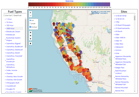
access to live and dead fuel moisture observations integrated from the National Fuel Moisture
Database, 10-hour dead fuel moisture observations from Remote Automatic Weather Stations, as well as
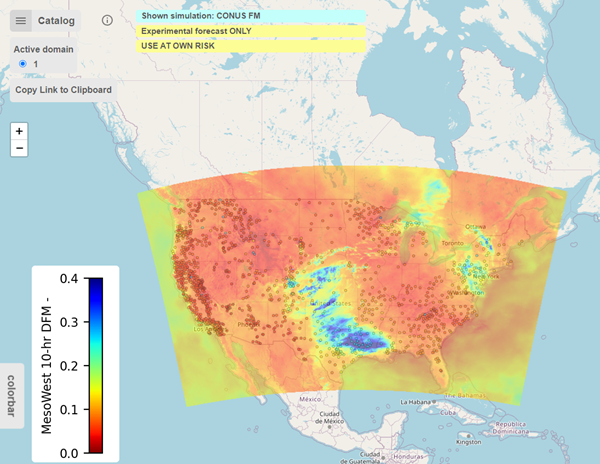
the hourly operational dead fuel moisture maps produced within the WRFx dead fuel moisture
assimilation system.

The National Fuel Moisture Database portal run by the Wildfire Modeling Group at SJSU Wildfire Interdisciplinary Research Center provides easy access to the observational data. It allows to query the database by geographical location, type, and observational period, plot the data, and download the data in CSV files. The portal computes mean monthly values over the observational period of each sampling station and shows how the most recent observations compare to typical values as well as the lowest fuel moisture observations on record. Click here!
The dead fuel moisture assimilation system run operationally by the Wildfire Modeling Group at Wildfire Interdisciplinary Research Center leverages data from remote automatic weather stations (RAWS) to capture spatial and temporal variability in dead fuel moisture content (FMC) for wildland fire risk assessment and fire modeling. The technique utilizes a trend surface model (TSM) to account for the spatial variability of FMC influenced by topography and atmospheric conditions. This TSM generates pseudo-observations of FMC at various locations, which are then assimilated into a time-lag fuel moisture model using Kalman filtering. This method has shown to be effective, particularly in comparison to traditional inverse squared distance interpolation methods, and it helps enhance the accuracy of FMC estimates in unobserved fuel classes. The dead fuel moisture data assimilation system generates spatial fuel moisture maps integrating observations and the output from the time-lag dead fuel moisture mode, that are used for fire risk assessment and as input into the fire spread models. Click here!


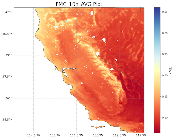
In order to provide a robust estimate of the spatial and temporal variability of the dead fuel moisture the Reanalysis Dead Fuel Moisture Content (DFMC) Dataset of California from 2000-2020 has been generated. The product leverages the potential of data assimilation, a technique that combines observational data with model outputs, to enhance the accuracy and spatiotemporal resolution of the data. The modified Fuel Moisture Data Assimilation (FMDA) system, which integrates fuel moisture observations from Remote Automatic Weather Stations (RAWS) into a simplified fuel moisture model was deployed to create a 2km gridded fuel moisture product for California that offers superior quality when compared to the output from fuel moisture models. The product is intended to support examining historical fire activity concerning climatological fuel moisture trends and enhancing fuel moisture models in the future.